
It’s a beautiful day here in Richmond. I thought I would share some historic photos of Richmond VA’s past so that you locals and visitors can see what it looked like before you take the tour. This are all public domain photos from the National Archives and the Library of Congress, so feel free to use them…. and of course enjoy them!
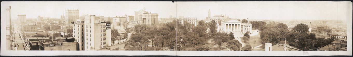
The best way to see this panoramic view of Richmond in 1919 is to click on it… take a look at the stark contrast between this and older photos. There are a lot taller buildings due to new construction methods and materials. The capitol that looks dwarfed by these buildings was at one time the top of Richmond’s skyline.
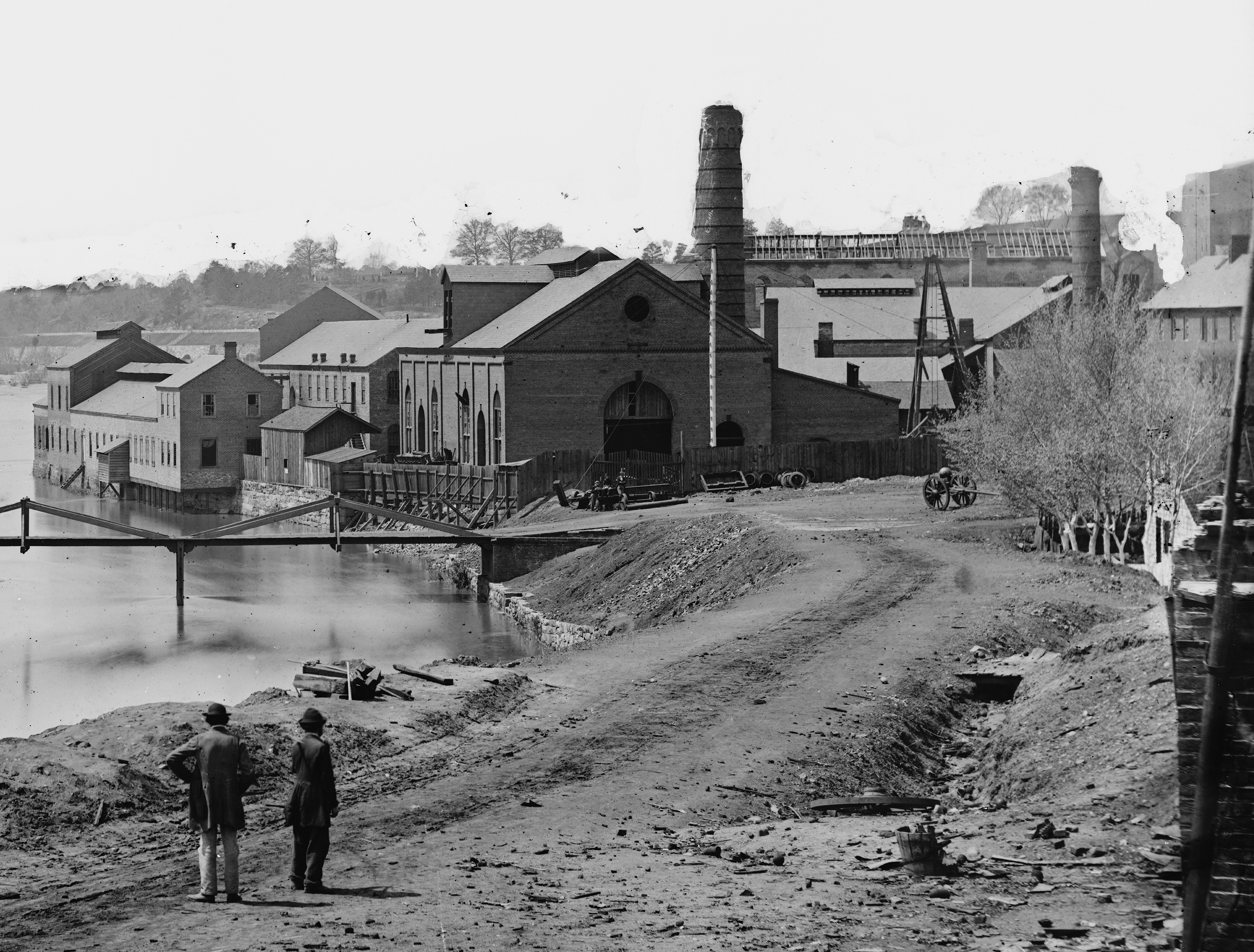
Tredegar Iron Works c. 1861: The Iron Maker of the Confederacy. The river and canals look a lot different than they do today. There’s no foot bridge to Bell Isle. (After all, why would you have a foot bridge from your prison to the city?). The canal passes by both sides of Tredegar, rather than the factory being surrounded by land as it is today. There were water mills that operate the equipment placed on both sides of the factory. Also, check out Thaddeus and Robert in the lower part of the picture. I don’t know if that’s their names, but I think it’s fun to pretend.
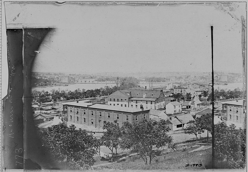
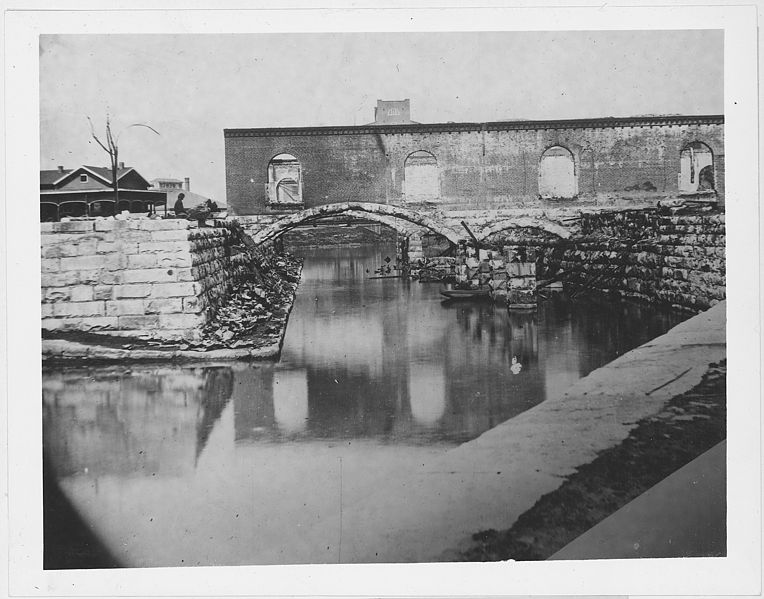
c. 1865
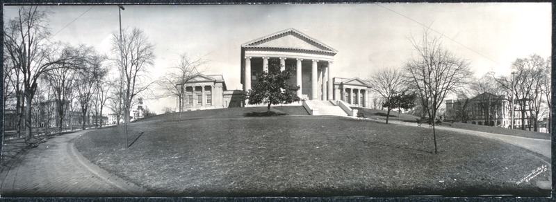
Panorama of Capitol Square C. 1919. At this time, cars or carriages drove right up to the capitol. The black fence that is there today is not there at this time. This picture was taken 13 years after the addition of the East and West wings and 90 years before the underground museum and office space was added. You can still attend free tours at the capitol every day except Sunday.
The old Gallego/Haxall Canals c. 1865. Flour milling was big industry in Richmond in the 19th century. The two largest were Gallego (Spanish name, Gah-yay-go) and Haxall. Today it looks much different, as it had fell into ruin and was restored a few years back. If I’m not mistaken, you can still walk under this bridge (as we do on the tour) and see the flume that expels water used by the Gallego Mill to power it’s equipment.
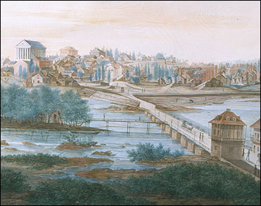
Richmond c. 1812….. this was the approach from Mayo’s Bridge. The Capitol, perched atop Shockoe Hill, dominates everything else in this picture. Up until the late 19th Century, when people in the new world approached Richmond this Roman temple inspired capitol building was the first thing that they saw. Many buildings began to resemble this Neo-Classical design eventually, but Richmond was the first to have this old world/new world meeting of styles.
Hope you enjoyed the photos! I will periodically post these as I run into hiccups in research for informational articles.